Combining local knowledge and expertise, field data, and state-of-the art tools is helping improve our understanding of the forest-water-climate nexus in the headwaters of the Zambezi River
Forests, water and climate are inextricably linked. Forests support consistent and quality water supply and help reduce flood and drought risks1. This is especially important as climate change can prolong periods of droughts and floods, and increase their frequency. Forests sequester carbon dioxide and create cooling effects, regulating local and global climates. On the other hand, climate change can lead to forest loss by exacerbating stressors such as forest fires, pest infestations and diseases. The resulting forest loss and degradation further contributes to climate change – leading to a reinforcing feedback cycle that can have detrimental impacts on forests, water and climate.
This is the forest-water-climate nexus. Understanding this nexus and considering the impact of changes in one component on the other is essential to ensure the provision of services from forests. Changes in this nexus can result in impacts on biodiversity, food systems and the livelihoods of local communities. Therefore, understanding trade-offs and synergies within the nexus is vital for forest and water management, as well as climate change mitigation and adaptation.

Figure 1: Forests regulate water quality, quantity, and timing (FAO)
The Zambezi River: Critical for environmental and economic systems in the Basin but threatened by deforestation, forest degradation and climate change
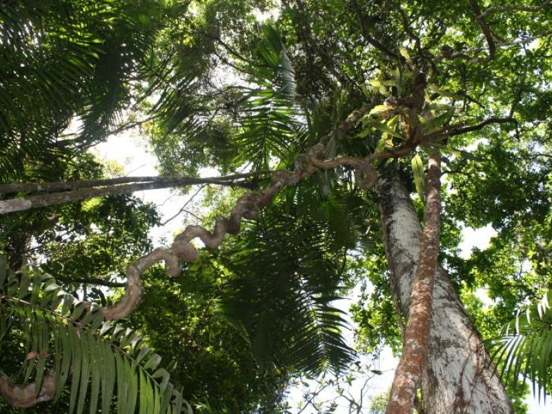
The Zambezi River Basin is the fourth-largest river basin in Africa. Its total area represents about 4.5 per cent of the continent’s area and spreads over eight countries - Angola, Botswana, Malawi, Mozambique, Namibia, Tanzania, Zambia, and Zimbabwe. The Zambezi River Basin has 13 sub-basins and a forest cover of about 39 percent3, providing water and carbon services, and supporting the local economy and livelihoods of millions of people. The forested headwaters of the Zambezi River in Zambia’s North-Western province face threats of deforestation and forest degradation, primarily due to agricultural expansion, mining, charcoal production, and infrastructural development. Furthermore, climate change is expected to increase temperature and decrease annual rainfall while increasing extreme rainfall events. This makes the headwaters of the Zambezi River highly vulnerable to climate change.
Figure 2 shows the five target headwater districts in Zambia's North-Western province.

Collaboration, local data, models, monitoring tools and capacity building are essential for understanding the forest-water-climate nexus and informing decision making processes

Figure 3: Riparian areas in the Zambezi River headwaters (FAO)
Recognizing its importance and value, UN-REDD Programme's Technical Assistance to Zambia has focused its work on the headwaters of the Zambezi River - the area with the highest forest cover in the country. From 2023-2024, the Food and Agriculture Organization of the United Nations (FAO) within the UN-REDD Framework and with the support of the Foreign, Commonwealth and Development Office of the United Kingdom (FCDO), the Polytechnic University of Valencia (UPV), and the University of Zambia (UNZA), delivered a Forests-Water-Climate assessment in the headwaters of the Zambezi River in Zambia.
The assessment involved a remote-sensing-based characterization of the study area and modelling of forest-water-climate relationships using Decision Support System (DSS) tools. It was done in two tiers where Tier 1 covered five districts and seven sub-basins. Tier 2 covered a catchment in one of the sub-basins and included local data to improve and calibrate the model as global data products of lower resolution are difficult to apply in these areas. A socio-economic survey was conducted to gauge community perceptions on forest-water-climate linkages and contextualize the model results. The use of local data was made possible through extensive field work carried out by the UNZA with support from the Forestry Department and local communities. The assessment highlighted the importance of using local data and knowledge in global models to generate more contextualized results, and the need for local partnerships and capacity building. Some of the key findings were: Sustainable Forest Management (SFM) by Community Forest Management Groups (CFMGs) is critical for achieving climate resilience and multiple benefits from the headwaters of the Zambezi. SFM by CFMGs can result in win-win outcomes for ecosystem services and community economic development. For example, one of the modelling scenarios of sustainable forest management with low intensity thinning of specific trees, showed that this could have water and carbon benefits, and enable communities to boost income from timber.
Empowered Stakeholders and Data-Driven Approaches Enable Effective Management
Building capacity across all levels - from local communities to district and national level authorities - is essential for sustainable management of the Zambezi’s headwaters. Data and tools can support decision making by communities and governmental actors such as forest or water authorities. For example, in the development of forest management plans or watershed management plans, evaluation of restoration initiatives, and carbon projects or opportunities for PES schemes.
Integrated, scalable strategies foster long-term landscape resilience. The methodology's replicability - incorporating forest inventories, local knowledge, and research - allows for scaling across regions highlighting the importance of strengthening local institutions. By linking SFM with processes such as Integrated Water Resources Management and other relevant initiatives, holistic landscape management that optimizes ecosystem services, involves all stakeholders and balances priorities can be achieved. Ultimately leading to more resilient forests, watersheds and communities in the face of climate change.


Figure 4: Field data collection as inputs for models
Stakeholder communication, collaboration critical for leveraging forest-water-climate interactions for decision-making
The methodology of this assessment was validated and the results shared through multi-stakeholder workshops in 2023 and 2024. These workshops included representatives from government agencies such as the Forestry Department, Zambia Meteorological Department, Ministry of Water Development and Sanitation, National Remote Sensing Centre, the Water Resources Management Authority (WARMA), and parastatal energy utility company ZESCO. His Royal Highness Chief of Ntambu and members of Community Forest Management Groups (CFMGs) from the Northwestern Province also participated in the results-sharing workshop. Academia represented by the University of Zambia, Zambia Forestry College, and Copperbelt University were also present. Civil society organizations attending the workshops included the World Wildlife Fund (WWF), Africa Regional Centre (CUTS), CIFOR–ICRAF, the FCDO-funded Climate Compatible Growth (CCG) project, Community Markets for Conservation (COMACO), WeForest Zambia, and the West Lunga Conservation Project (WLCP). Trainings were also undertaken to ensure knowledge transfer and integration.


Figure 5: Results sharing and capacity building
The workshops and trainings facilitated robust discussions on ideas, initiatives and challenges faced in Zambia for managing headwater forests, especially when there are multiple priorities that generate trade-offs and synergies. For example, deciding between charcoal production, carbon market projects, water protection, timber harvesting, productive systems and local livelihood activities. The workshops showcased the need for more regular communication and collaboration among government, local communities, academia and CSOs to discuss results and prioritize management objectives, ultimately improving landscape level management of the Zambezi headwaters.
“This modelling exercise is very useful for our decision making and as it enhances our understanding of the linkages between forest, water, and climate,” said Steven Munyandi, a young community member who attended the workshops.
“We can review our forest management plans where we did not consider these linkages,” he added.
The workshops and trainings also featured an intergenerational and interdisciplinary aspect that enriched the discussions and highlighted the need for different viewpoints to understand sectoral landscape management objectives. The workshops brought together the technological skills of young professionals, scientific knowledge of researchers and field experience of district-level forestry officers. They also improved the understanding of policy and national processes of government officials, and local knowledge of community members and NGOs - leveraging the different types and levels of knowledge and skills to create an integrated understanding of the forest-water-climate nexus. This highlighted the importance of building the knowledge bases and skills of multiple groups for improved management of forest resources in the headwaters of the Zambezi River.
The forest-water-climate assessment has confirmed that sustainable forest management with local communities at its core, can enhance ecosystem services, balancing environmental and socio-economic objectives. Building on the momentum generated by these efforts, it is important to use these findings in the development of forest management plans and business cases at district level.