Uganda
Mapping forests
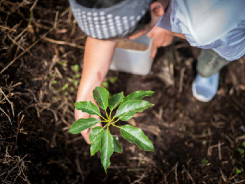
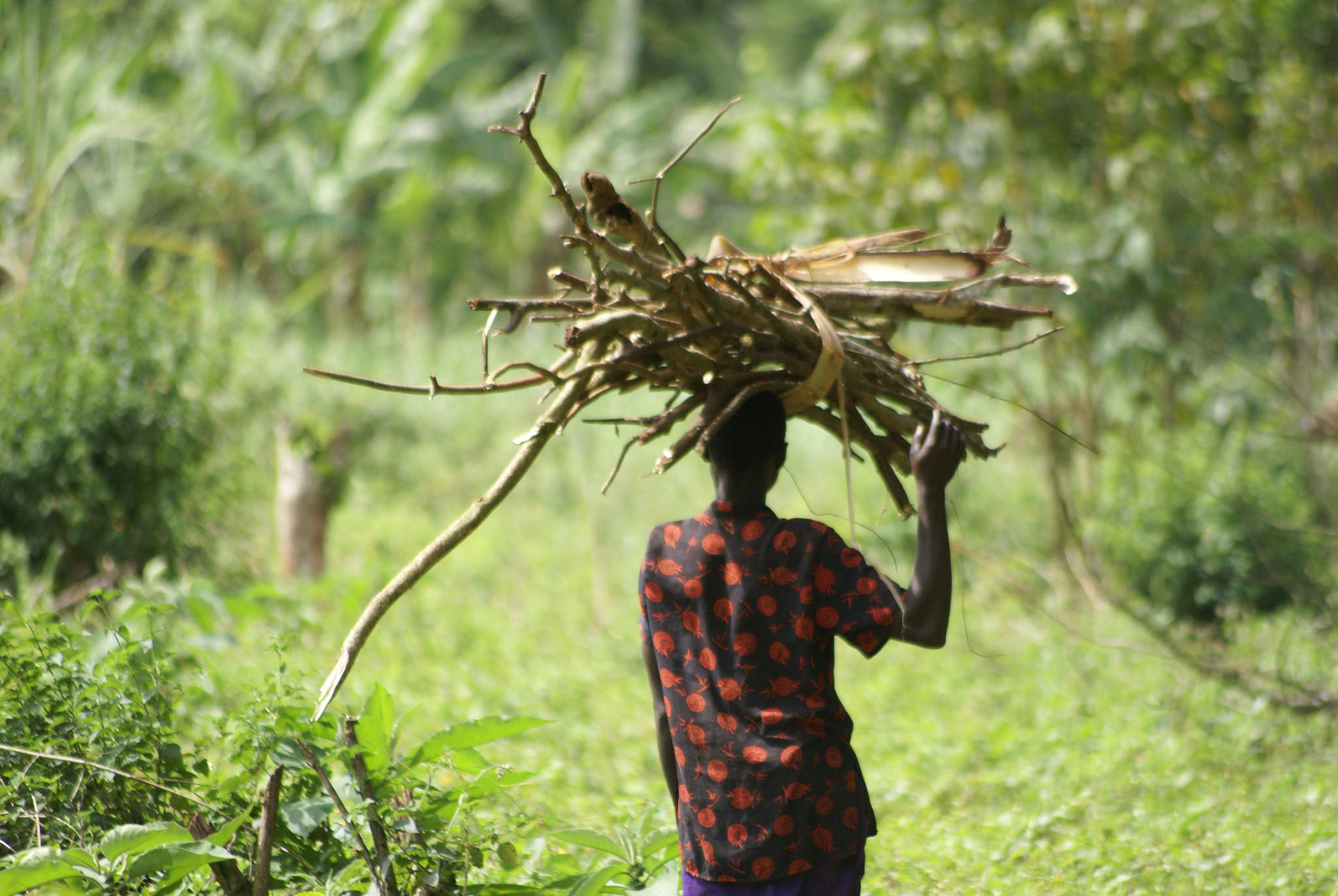
“Forests give us medicine, good air and rainfall, all things that are very important for us.”
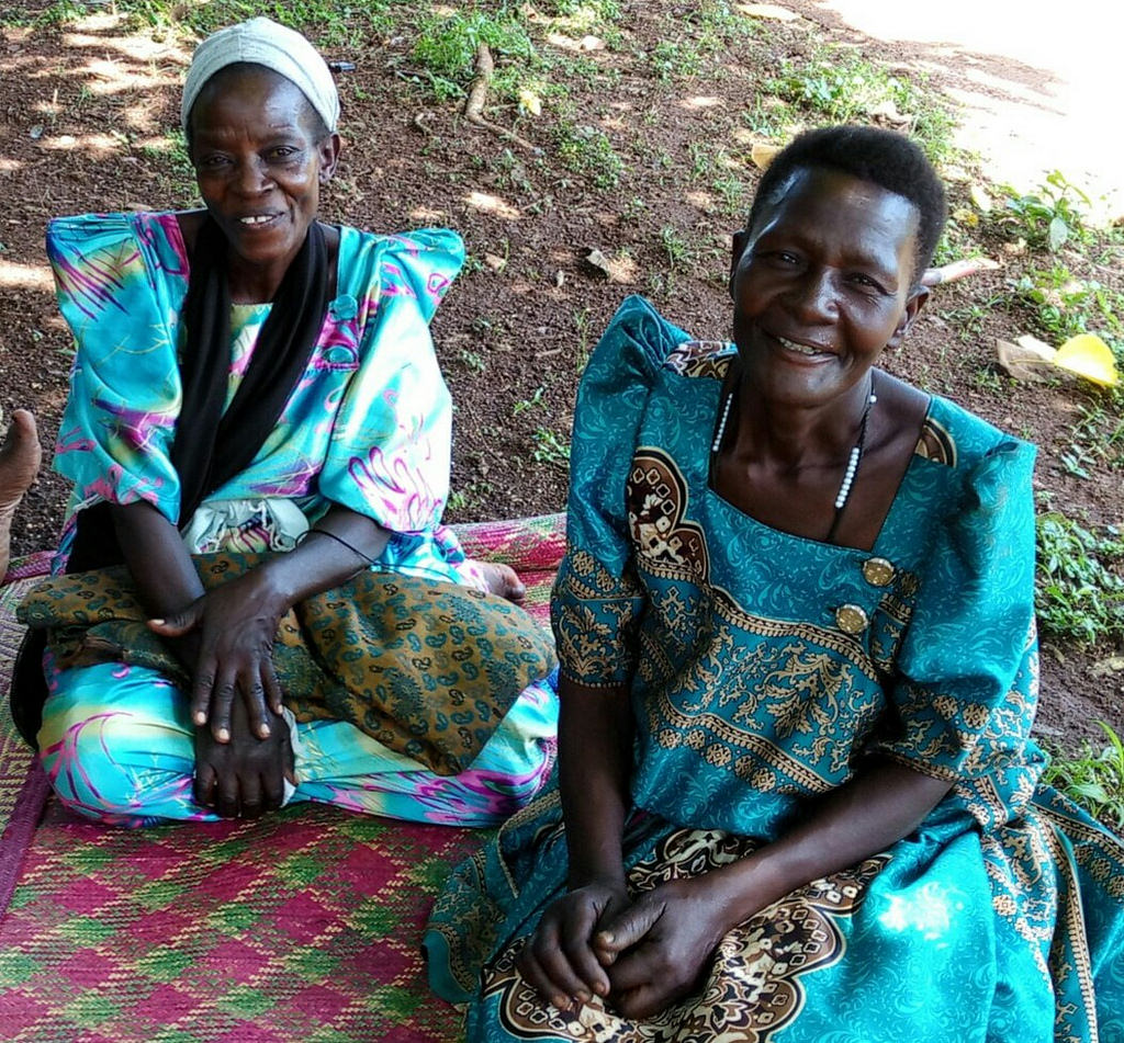
Natolo Noar and Bulyaba Scovia are carpet weavers from the Nagoje community in the Mabira forest of Uganda.
The women are part of the local biodiversity organization, NACOBA, and to supplement their income, they collect palm leaves from the forest and weave carpets that are later dyed with local products.
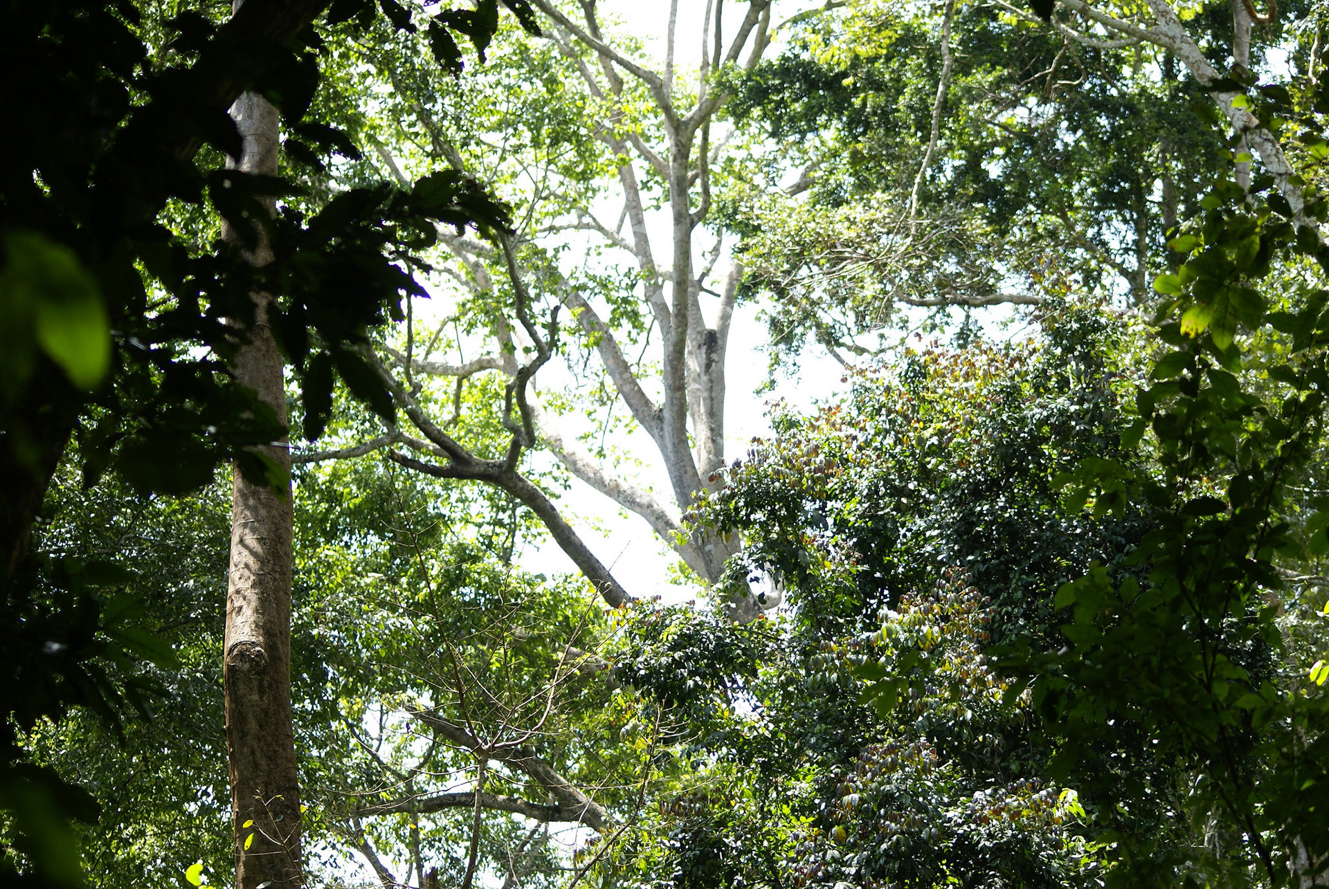
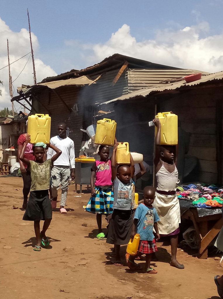
The forest supplies these women with palm leaves, and also provides them with water, medicine and wood for fuel. But the Mabira forest is at risk due to an increasing population, high demand for charcoal and agricultural encroachment. The Mabira is a rainforest area covering about 300 square kilometres, home to many endangered species like the primate Lophocebus ugandae, a species of Old World monkey found only in Uganda. It is one of the biggest reserves in the country.
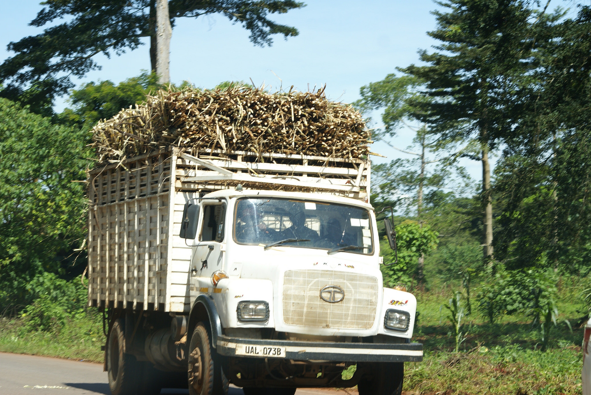
Uganda has experienced severe deforestation over the last decade. In fact, the country has one of the highest rates of deforestation and forest degradation in the world. In 1990, forest cover was estimated at 24% of total land area. By 2015, it was down to 12.4%. Today, it is at 9%. Many of the remaining forests reside in protected areas, under the protection of the NFA (National Forest Authority) and the UWA (Ugandan Wildlife Authority).
Drivers behind deforestation in Uganda include the harvesting of fuelwood as more than 90% of household energy is derived from firewood and charcoal. Other factors include harvesting construction timber and land conversion for agriculture, especially sugar cane.
In the Mabira, as in many other parts of the country, access to water is a daily struggle. For Natolo Noar and Bulyaba Scovia, working with the NFA has offered them a chance to participate in the conservation of the forest and in accessing water. “We help the NFA with the conservation of this forest by talking to our communities and telling them about the importance of the forests and why they should not cut it but rather replant and restore it,” says Natolo Noar. “Forests give us medicine, good air and rainfall, all things that are very important for us. In return, the NFA allows us to collect dry firewood, water and medicinal herbs for domestic use on certain days. Before the NFA was like our enemy, but now, for the past ten years, we have a good relationship.”
The NFA has also provided the community with beehives, as well as seedlings for planting. “They have brought us together as a community,” says Natolo Noar.
Mapping Uganda's forests
To help forests like the Mabira, the government of Uganda launched its National REDD+ Strategy in November, 2017. This includes developing plans and options for forest management to reduce carbon emissions and maintain valuable ecosystem services such as biodiversity, water supply, soil protection and wealth creation for sustainable livelihoods. With REDD+, the country has an opportunity to manage its forests in a balanced way for long-term, sustainable economic growth, to support the livelihoods of local, rural and forest dependent communities, and to ensure the conservation of its natural heritage.
National forest monitoring system
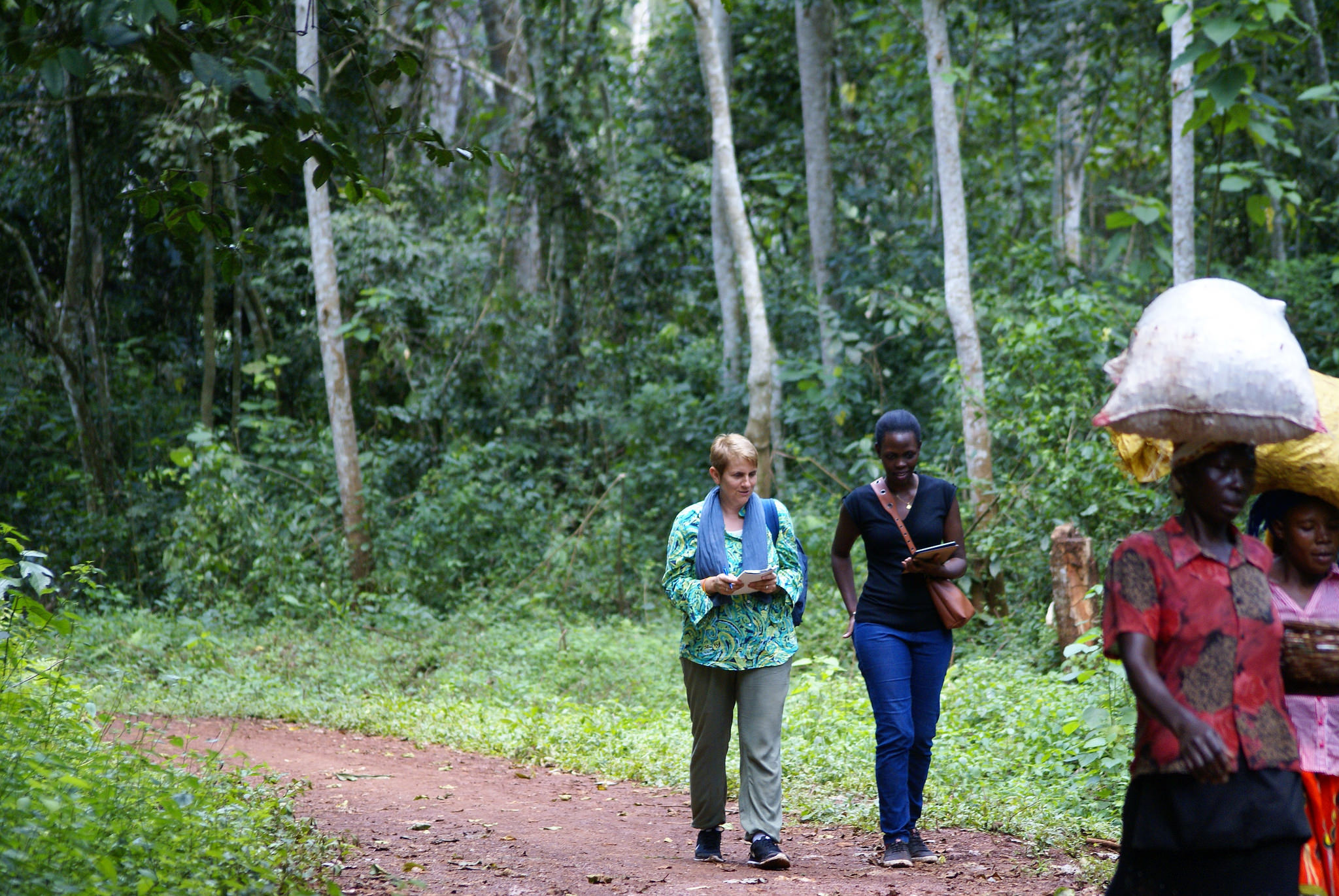
“Uganda is not only interested in collecting data for carbon reporting purposes, but also for its own national needs,” says Rebecca Tavani, NFI Forestry Officer with FAO. “The country has decades of experience with forest inventories and satellite land monitoring. FAO’s support seeks to strengthen coordination of this knowledge and make it more efficient by introducing open-source software that FAO has developed, making it easier to collect and process data.”
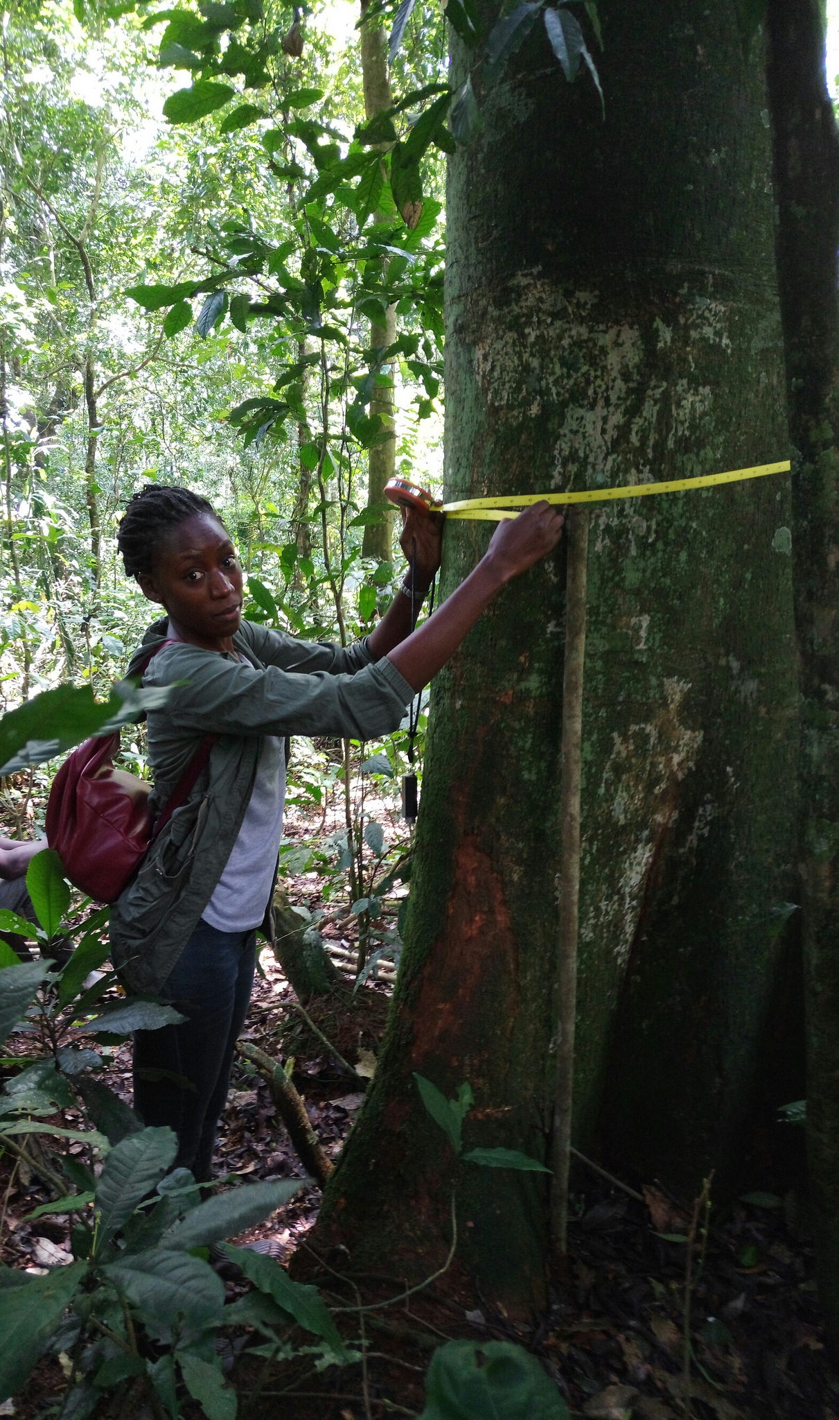
This software includes the Open Foris suite of tools as well as SEPAL, a cloud-based platform that helps countries with geospatial analysis of forest and land uses. These tools allow for the quick processing of data, enabling Uganda to more rapidly understand the extent of forest cover change and related carbon emissions. In order to measure the carbon stock in each of the forest sites, forest inventory teams measure the height, diameter and density of trees.
“Before, forest inventory was only used to inform the government on the availability of wood and to understand the biodiversity of its forests,” says John Begumana, MRV/NFMS specialist with FAO . “At that time, we were only looking at forests with timber. Now, we also look at forests without timber, with wood including bamboo, local palm trees and eucalyptus. Now, we even look at dead wood. REDD+ helps us in knowing how much carbon we are releasing if we lose a particular part of the forest. It tells us about carbon stocks in different forest types.”
It takes a community
John Dissi, a coordinator with GIS and Mapping with the National Forest Authority, has been drawing maps by hand since 1990. “A lot has changed since then,” says Dissi. “Now, there are free satellite images that tell us about the cover of a country, such grassland or wetland. And with that, I make the land cover map. Then the inventory teams measure the trees and calculate the carbon stock to make the biomass inventory.”
Dissi interprets the images to make a digital map. “I am proud to do this job because people take data for granted, but it’s a whole process to get it. And by making the maps I sound the alarm bell. I show people and policy makers that there is a problem and where exactly they have to intervene with afforestation or other measures.”
Brenda Nagasha, a biomass supervisor with the National Forest Authority measures the height and diameter of trees to update the maps on biomass inventory. “I have been doing this for six years now,” she says. “It’s important to have accurate maps and reports on the status of the forests so that management teams can make wise decisions. For my job, I sometimes camp for thirty days straight in the forest and walk up to 15 kilometres a day. But I love nature and I am happy that through my work I can help protect the environment.”
There are three kinds of forests in Uganda: government-owned areas and national parks, forests under local management and community-owned forests. “Where the community is adjacent to protected forest reserves, we work together with them so they can get access to non-timber products such as water and herbal medicines in exchange for helping us monitor the forests,” says Xavier Mugumya, Climate Change Coordinator and Alternate National Focal Point for the national REDD+ secretariat, National Forestry Authority. “As for the UN-REDD Programme, we asked them for assistance because we value the expertise from each of the three agencies. They helped us advance and get international exposure.”
Robert Otuko, a forest inventory supervisor with the NFA has been working in the forest for the past twelve years. “My main tools as a field inventory supervisor used to be a compass and a linear tape,” he says. “These days I use a GPS and tablet. It is by giving this information to the government that they can see the status of the forest and decide what conservation policies to develop.” Mapping teams in Uganda are currently working on land cover for 2017, with an estimated completion date in 2019.
By: Griet Ingrid Dierckxsens, Regional Africa Communications and Knowledge Management Specialist, UN-REDD Programme
More stories of change